Sailing Companion · Blog

Captain's Log

Updates and background stories from the team behind the app.

v1.6.1 & v1.6.2 — cross bearing, expense splitter, and a smarter cockpit

v1.6.2cross bearing & expense splitter

Two quick releases following the big v1.6 toolbox update. v1.6.1 and v1.6.2 add two brand-new tools, a handful of new cockpit metrics, and a round of polish across navigation, Apple Watch, and the logbook. Here's everything that landed.

New tools

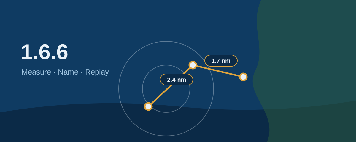
Cross bearing. Take two compass bearings through your iPhone's camera, and Sailing Companion plots your position fix on a nautical chart with distances — then saves it to the logbook. A classic navigation technique, now done without pencil and paper.

Expense Splitter. Record trip costs and who paid, split them among the crew, attach receipt photos, and instantly see who owes whom. No more spreadsheet at the end of a charter week.

Cockpit & metrics

New metrics arrive on both iPhone and Apple Watch: heel angle, VMG (velocity made good to the active waypoint), trip distance, and trip duration. The heel-angle readout includes calibration for any mounting position and a "capsized" display beyond ±90° — because knowing how far over you are is half the fun.

Changing a tile's metric is now easier too: touch and hold to pick from a menu (swiping still works), and the layout is cleaner without the page dots. A one-time tip shows you how it works the first time you open the cockpit.

Navigation & maps

Logbook entries — including cross-bearing fixes — now appear as markers on the Navigation map and on your trip maps, so the story of your trip is visible right where you sailed it. Measurement rings switch to white in dark mode for better contrast on dark charts, and music now ducks before spoken announcements like "Waypoint reached" so you actually hear them.

Apple Watch

Your wrist gets a bit smarter: sound and haptic feedback when you reach a waypoint or your destination, and the storm / pressure-drop alert can now be acknowledged right on the watch — no need to fetch your phone in a squall.

Trips & logbook

When you start a trip, you can now add Skipper, Co-Skipper and Crew — shown in the trip details and included in the PDF and other exports. A small detail, but it makes the logbook feel like a proper record.

Get the update

Version 1.6.2 is available now on the App Store. As always, it works fully offline — no signal required out at sea.

Fair winds,
— Bernd

Share

Sailing Companion 1.6 — your boat's new toolbox

v1.6your boat's new toolbox

When you're on the water, the little things matter: knowing the barometer is falling before the wind does, remembering the checklist before you cast off, recognising a buoy you've never seen before. Version 1.6 of Sailing Companion is all about those little things — and it's our biggest update yet. It turns the app from a logbook-and-tracker into a proper on-board companion. Here's what's new.

A new Tools tab

We've gathered everything practical into one place. The old Anchor tab has grown into a Tools tab, home to Anchor Watch and four brand-new tools.

Barometer

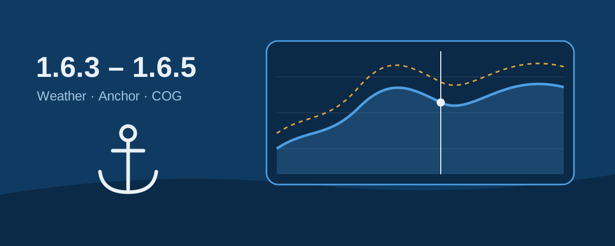
Your iPhone has a barometer built in, and now Sailing Companion puts it to work. You get a live air-pressure reading and a history graph, recorded throughout your trip — even while paused or at anchor. If the pressure drops sharply (the classic "3 hPa in 3 hours" storm signal), the app warns you, with a red badge right on the navigation map so you don't miss it. There's also a short, plain-language guide to what the readings mean.

Checklists

Five ready-made lists come built in — Safety Briefing, Anchoring, Charter Check-In, Charter Check-Out and Abandon Ship — covering the things that are easy to forget and important to remember. You can tick items off, edit them, and create your own checklists with a choice of icons. Perfect for crew briefings and charter handovers.

Nautical Information

A pocket reference for the things you can never quite recall: international signal flags, cardinal and lateral marks (now with proper buoy illustrations), the lights ships show at night, chart light characteristics, sound signals, the COLREGs "rules of the road", distress signals, Morse code and the Beaufort scale. Ideal for studying, teaching, or a quick check on passage.

Morse light

Signal SOS — or any text you type — using your iPhone's flashlight, with an option to repeat automatically. A genuinely useful tool to have in your back pocket in an emergency.

Smarter anchoring

Anchoring got a lot of attention this release. When your anchor is down, a clear reminder now sits on the navigation screen so you never forget to raise it. Drift more than 200 metres from where you dropped, and the app asks whether you'd like to raise the anchor — a gentle safety net for the moment you get distracted. Drop or weigh anchor and Sailing Companion can pause or resume your trip recording for you. On the map, the swing circle now fills the screen nicely so you can see exactly where you sit.

Apple Watch improvements

Your wrist gets more capable. You can now start a trip straight from the watch, drop the anchor without reaching for your phone, and the cockpit tiles fit neatly on screen without scrolling. New status icons tell you at a glance if the watch has lost GPS or its connection to your iPhone.

Faster with big trips

If you sail long passages, you'll have noticed that very large tracks could slow things down. Merging, deleting and importing big multi-day trips now happen in the background with a progress indicator, so the app stays responsive while it works. Your trip statistics now also show the number of recorded data points, and durations over a day are written out in days, hours and minutes.

Easier to read, in more languages

We added an "Increase text size" option for clearer reading in bright sun and bouncy conditions, and a confirmation step before ending a trip so you don't stop recording by accident. The Track tab is now called Navigation. And Sailing Companion now speaks five more languages — Slovenian, Polish, Hungarian, Albanian and Finnish — bringing the total to twenty.

Get the update

Version 1.6 is available now on the App Store. As always, it's built by sailors, for sailors, and it works fully offline — no signal required out at sea.

Fair winds, and let us know what you'd like to see next.
— Bernd

Share
ARTICLE_EOF echo "Article created." # Insert it into the blog HTML before the v1.5.3 article python3 << 'PYEOF' with open('sailing-blog-index.html') as f: html = f.read() with open('/tmp/new-blog-article.html') as f: article = f.read() # Insert before v1.5.3 article insert_pos = html.find('
') new_html = html[:insert_pos] + article + html[insert_pos:] # Also add the new post to the sidebar TOC toc_entry = 'v1.6.1 & v1.6.2 — cross bearing, expense splitter, and a smarter cockpit' toc_pos = new_html.find('v1.6.1 & v1.6.2 — cross bearing, expense splitter, and a smarter cockpit') # Insert after the v1.6 TOC entry toc_end = new_html.find('v1.6.1 & v1.6.2 — cross bearing, expense splitter, and a smarter cockpit', toc_pos) + 4 new_html = new_html[:toc_end] + toc_entry + new_html[toc_end:] with open('sailing-blog-index.html', 'w') as f: f.write(new_html) print("Blog article inserted.") PYEOF

v1.5.3 — speed-colour tracks, day-by-day statistics, and Watch upgrades

Sailing Companion v1.5.3 — Out now

Four days, three App Store releases, and a steady stream of improvements. Sailing Companion v1.5.3 is now live, capping off a productive sprint that started with the v1.5 launch last week. Here's everything that landed across 1.5.1, 1.5.2, and 1.5.3.

Speed-colour track display

The trip track on the map can now be coloured by speed — slow sections in cool blue, faster sections warming up through yellow and orange. It's immediately easier to read at a glance where you were pushing, where you were becalmed, and where the current was doing the work for you. The colour legend appears automatically when the mode is active.

Day-by-day statistics for multi-day trips

For anyone doing overnight sails or longer passages, the statistics view now breaks a multi-day trip down by individual day. Each 24-hour segment gets its own set of stats — distance, avg speed, max speed, time under sail — so you can compare a rough day against a perfect one without exporting anything. Pull up a trip from last season and the breakdown is right there.

Apple Watch — waypoint notifications and UX polish

Waypoint reached notifications now work on Apple Watch, not just iPhone. When you cross into a waypoint's target circle, the Watch fires the same voice notification it does on the phone — you don't need to look at either screen to know the next mark is approaching. On top of that, both iPhone and Apple Watch received general UX improvements to the waypoint navigation flow, making it faster to browse a route and confirm your next leg.

MOB function — standalone mode and full-screen maps

The Man Overboard function now works even when no trip is recording. If you need to mark a position and navigate back in an emergency, there's no need to fumble with the record button first — MOB triggers immediately and tracks your return. The voice announcements for MOB are also now localised in all 15 supported languages.

Meanwhile, the Trips view gets a visual upgrade: trip tracks now animate across the map in full-screen, so reviewing a day's sail feels a little more like reliving it.

Also new across 1.5.1–1.5.3

  • Bug fixes and improved translations across all supported languages
  • Simplified Settings tab for easier navigation

Get it

Update Sailing Companion on the App Store — open the App Store, tap your profile icon, and pull to refresh. If you've been holding off on the Watch app, updating the iPhone app installs it automatically.

Fair winds,
— Bernd

Share

v1.5 — Apple Watch support and a MOB button that talks back to you

Sailing Companion v1.5 — Out now

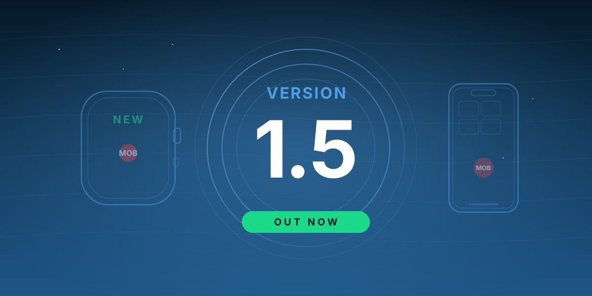
Another major milestone for Sailing Companion. v1.5 is live on the App Store now, and it takes the app one step closer to what I've been working toward since day one: a truly universal, professional sailing tool that goes with you from planning to helm to post-sail storytelling — and now, onto your wrist.

Apple Watch — Sailing Companion, now even more personal

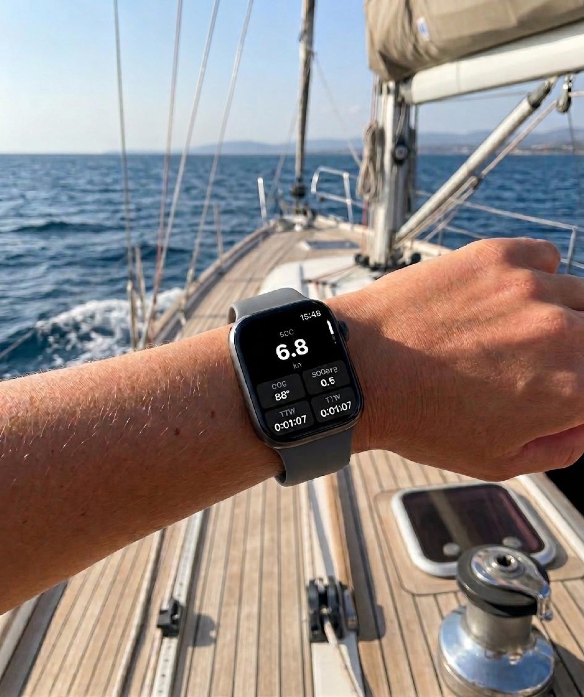
This is the feature I've been quietly building toward, and it changes how you interact with the app on the water. Sailing Companion now runs on Apple Watch, giving you key sailing data at a glance — right on your wrist, without reaching for your phone in a seaway. The core features you know from the iPhone app are all there: the Cockpit with all your sailing metrics, Logbook entries so you can log a trip event without pulling out your phone, Anchor Alarm monitoring — and triggering — right from your wrist, and of course MOB, which deserves its own section.

The Watch shows all sailing metrics from the iPhone app — currently more than 10 — right on your wrist: SOG, COG, heading, and plenty more. There's a simple 3-tile layout for a clean glance, and a denser 7-tile layout for more demanding sailors. Every tile can be customized by swiping to swap in your preferred metrics, so the Watch face shows exactly what you need — nothing you don't. It's designed to be readable in bright sunlight and fast to launch. The Watch keeps its connection to the iPhone even when the phone display is off — so your metrics stay live on your wrist without draining the battery.

Apple Watch on a sailor's wrist at the helm, showing the Sailing Companion cockpit tiles with SOG, COG, HDG and TTW — bright sunlight, no need to reach for the phone.
The Apple Watch face — readable in bright sunlight, live at the helm.

Logbook on your wrist

The moment the anchor drops or anything noteworthy happens, just raise your wrist, tap a logbook entry type, and speak your notes into the Apple Watch. The entry is populated on the iPhone automatically — no typing, no fumbling with a phone below decks. When the trip is over, the logbook exports cleanly with all the details you'd want for a proper trip record.

"Man Overboard" — now on iPhone and Apple Watch, with voice

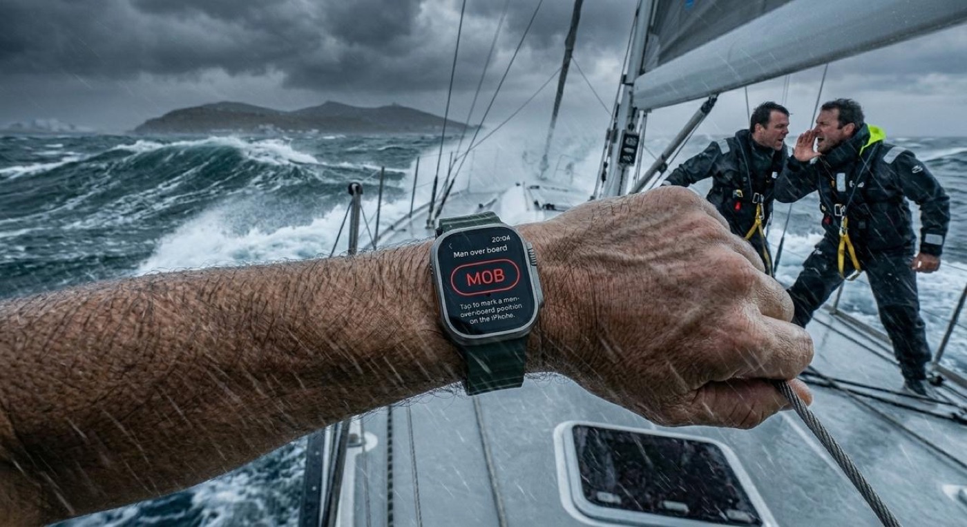
Man overboard is the scenario every sailor trains for and hopes never to use. v1.5 adds a dedicated MOB (Man Overboard) button right on the iPhone Track tab and Cockpit tab, and as a dedicated screen on Apple Watch — making it easy to trigger should the event ever occur.

Apple Watch on a sailor's wrist displaying the Sailing Companion Man Overboard screen, with two crew members on deck in rough seas.
One tap on the Apple Watch — or on the iPhone Track and Cockpit tabs — marks the MOB position instantly and starts tracking the way back.

One tap marks the position instantly and creates a logbook entry automatically, including the GPS position. From that moment, the app tracks distance and bearing back to the MOB point — and if activated, announces the distance by voice every 15 seconds. "Man overboard. Distance 80 metres."

This is the kind of feature I hope you never need — but if you do, it's the one that matters most. Having it on the Watch means it's always one tap away, even when your phone is below decks or in a dry bag.

Where this is going

Apple Watch support isn't just a checkbox feature. It's the foundation for what comes next: haptic feedback on waypoints, and many more ideas I'm excited about. Sailing Companion started as an iPhone app. It's becoming a sailing platform — phone, watch, and eventually more. v1.5 is the step that makes that real.

Also new: Danish

Sailing Companion is now available in Danish too, bringing the total to 15 supported languages.

Get it

Update Sailing Companion on the App Store — open the App Store, tap your profile icon, and pull to refresh. The Watch app installs automatically once you update the iPhone app.

Fair winds,
— Bernd

Share

v1.4 is out now — the biggest update since launch

Sailing Companion v1.4 — Out now

It's been a long few weeks of testing, polishing, and a few more testing rounds — but Sailing Companion v1.4 is live in the App Store right now. This is the biggest release since the app launched, and I'm really proud of how it turned out. Three big things landed in this version, and together they change what the app can do for you at sea and back at the dock.

1. Complete waypoint navigation

Waypoints were always on the roadmap, but I wanted to ship this right rather than ship it fast. In v1.4 you get a full waypoint navigation system: drop waypoints on the map, build a route, and follow it. The app tracks bearing, distance, ETA, and the current leg is highlighted so you can see what's next at a glance. Routes can be reordered and saved for later.

The part I'm most happy with: waypoint reach detection. When you cross into the target circle of the next waypoint, the app fires a sound and a voice notification — "Waypoint reached" — so you don't have to look at the screen in a choppy seaway or when both hands are on the wheel. It works the way you'd expect a real crew member to: clearly, once, and at the right moment.

2. Social media content generator

Trips are stories, and v1.4 is built for telling them. The new social media content generator produces ready-to-post videos and photos from your trip — with overlays of your sailed track, distance sailed, or live data baked right into the export. The overlays are timecoded to the video, so your stats line up with what the viewer is actually seeing on screen. Drop the result into Instagram Reels, TikTok, or YouTube Shorts as-is.

Photo exports get the same treatment: clean templates, tasteful typography, and a choice of overlays so a single day on the water can become a series of polished posts in minutes.

3. Trip export & import — the new .sca package

Your trips should be able to move with you. v1.4 introduces a new .sca package format that bundles a full trip — track, logbook entries, photos, voice notes, settings — into a single file. Export and import are first-class features now, and the file plays nicely with the iOS share sheet: send it to a co-skipper via AirDrop, pass it along in a messenger, or drop it into the Files app for backup. Same format whether you're moving a trip between two iPhones, archiving a season before a passage, or handing a logbook to a buyer.

Get it

Update (or download) Sailing Companion v1.4 on the App Store — open the App Store, tap your profile icon, and the update should be there. If you don't see it yet, give it a few hours; the rollout is staged.

Fair winds,
— Bernd

Share

v1.4 is on the way — the biggest update since launch

Sailing Companion v1.4

Just a quick update from the workshop: Sailing Companion v1.4 is in the final stretch of testing and polishing, and will be released very soon. It's the biggest update since the app launched — and it brings the most-requested features of the past weeks, all in one release.

What's coming in v1.4

Three big things — the kind of features you've been writing in about most often.

1. Full-blown waypoint navigation

Drop waypoints directly on the map and follow them as a route — for short coastal legs, club races, day-skipper passages, and getting safely into a tricky bay. Bearing, distance, ETA, current-leg highlight, route reordering, save for later. Everything you'd want, designed to stay out of your way while you're at the helm.

2. Great new photo & video export templates

Sailing Companion was always about telling the story of your trip — and v1.4 takes that seriously. Brand-new photo and video export templates are designed from the ground up for great social media content, so you can go from a stunning day on the water to a polished post in just a few taps. Templates for the major formats, tasteful typography, your tracks and stats baked in if you want them.

3. Export & import of trips, sharing via Files or AirDrop

Your trips are yours, and they should be able to move. v1.4 adds full export and import of trips, with first-class sharing through the Files app or AirDrop — perfect for moving a trip to another iPhone, sharing it with a co-skipper, or backing up an archive before a passage. GPX, of course, is in there too.

When can I get it?

Very soon. v1.4 is in final testing and polishing right now, and will roll out in the next app update. Keep an eye on the App Store — and on this blog, where I'll post the moment it goes live.

Thanks for the feedback that shaped this release. It came from you — every email, every App Store review, every conversation at the dock.

Fair winds,
— Bernd

Share

How I actually use Sailing Companion — three boats, one iPhone

Three boats.one iPhone, one app

I get asked a fair bit how I actually use the app I built, so this is a small field report from the three kinds of boats I sail — a tiny dinghy, a daysail keelboat, and the occasional charter yacht. Different boats, different layouts, and the same iPhone running Sailing Companion. The thing I have learned the hard way is that the boat does not need much for the app to be useful. It mostly needs a place to put the phone and a charged battery.

1. The dinghy — phone clipped to the mast

My own little boat has no electronics at all: no plotter, no instruments, no depth sounder, no shore power. There is also no obvious horizontal surface to rest a phone on. The trick that has worked best is a small handlebar-style mount clipped to the mast, just below the hounds, where the phone sits vertically and is visible from the tiller. From there I can glance down and see SOG, COG, the trip distance, and the elapsed time. The track is recorded for the whole sail without me ever touching the phone, which is the entire point — I am sailing, not screen-watching.

2. The daysail keelboat — phone on the metal rail by the companionway

The daysail boat I sail on most weekends is slightly better equipped, but only slightly. There is still no plotter and no other instruments, and the cockpit is small. The natural spot for the phone turned out to be a simple spring-clip mount on the metal rail just inside the companionway, where it is visible from the helm but out of the way of sheets and bodies. That is where Sailing Companion basically takes over: GPS track, logbook entries with a photo and a one-line note when something memorable happens, and a clean GPX at the end of the day. The crew is happy because the helmsman has a number to look at; the helmsman is happy because the logbook writes itself.

3. The charter yacht — phone above the built-in plotter

The interesting case is the charter yacht. Many of them have a plotter at the helm, but not all of them work, and even when they do, the user interface can be a generation behind what you are used to. So my habit now is to clip the iPhone to the helm console, right above the built-in plotter, and run Sailing Companion in parallel. The plotter still does what the plotter is good at — it shows the chart, the depth, and the AIS. Sailing Companion does the things I trust it to do — the GPS track, the logbook, the anchor watch, the cockpit metrics in the layout I already know, and the waypoint routes I can hand to the co-skipper. The two screens are doing different jobs, not fighting each other.

There is also a quiet but real benefit to running the app on a charter: my track is recorded on my device, in the export format I control, regardless of what happens to the boat. When the charter ends, the trip leaves with me. That alone is worth the small effort of clipping the phone in.

The anchor alarm is the real win on a charter

And then there is the anchor alarm — which on a charter is quietly the headline feature. When you tuck into a bay for the night, the boat's plotter and most of its instruments can be switched off at the breaker panel. The fridge stays cold, the beer stays cold, and the boat's house battery lasts a lot longer. The boat is essentially asleep. Your anchor watch, by contrast, is still very much awake — running quietly on the iPhone clipped to the helm, watching GPS, ready to wake the whole cockpit if the swing circle breaks.

There is a second, slightly less obvious advantage. Because Sailing Companion is a plain iOS app, I can run it in parallel on a second device — most often my iPad, lying on the chart table below. The two are watching the same GPS, the same anchor point, the same radius. If one of them has a hiccup — low battery, a glitch, anything — the other is still on the job. Two independent anchor watches, from two independent devices, sharing the same definition of "still anchored." It is the kind of redundancy I would not go without on a longer passage.

One small practical note, because people ask: at night, I always keep the phone and the iPad plugged into a power bank. Anchor watch is honest work for a battery — it is basically the GPS running the whole time — and a dead phone at 03:00 is the single most preventable anchor-alarm failure mode. A 10,000 mAh power bank and a short cable in the cabin is, in practice, the cheapest insurance on the boat.

What the app does not do (yet)

It is only fair to be honest about the limits. Sailing Companion currently does not show water depth — neither a chart with depth contours, nor a live depth readout from a sounder. It also does not show wind — not true wind, not apparent wind, not a wind shift graph. On the dinghy and the daysail those have never been a problem for me, because the wind is right there in my face. On the charter, the boat's instruments cover it. So the app is honest about being a sailing logbook and a track tool, not a full instrument package. If a future version reads wind or depth from external sensors, that is a story for another day.

Three boats, three mounts, one iPhone, one app. The common thread is simple: the phone is always where my eyes already are.

The point of all this

I built the app first and foremost for the way I actually sail, which is to say on a wide variety of boats, most of them modest, with whatever the boat happens to have on board. If Sailing Companion works on my own no-electronics dinghy and also plays nicely with a charter plotter, it will probably work for the boat you sail on too. And if it does not, that is the kind of feedback I want to hear about.

Fair winds,
— Bernd

Share

Where your tracks can sail next: GPX, OpenCPN, Google Earth and beyond

.gpx → anywhereyour track, in the open standard

Recording a track is only half the value. The other half is being able to take it anywhere — onto a chartplotter, into planning software, or simply draped over the globe to relive a passage. That is why Sailing Companion exports your tracks as plain GPX, the open standard, instead of locking them inside a private format. Your sailing is yours, and your data should travel just as freely as your boat does.

So what actually is GPX?

GPX — the GPS Exchange Format — is a simple, text-based file that stores a sequence of points: latitude, longitude, time, and sometimes elevation. Because it is an open standard, almost every serious mapping and navigation tool on the planet can read it. When Sailing Companion records your trip, it is keeping exactly this kind of breadcrumb trail, and exporting it is a single tap — no conversion, no account, no cloud round-trip.

Open it in OpenCPN

OpenCPN is the much-loved free chartplotter that runs on a laptop down below. Import your GPX and your track lays itself over proper marine charts, so you can study how you actually threaded that channel or where the tide set you off the rhumb line. It is a brilliant way to debrief a passage the evening after — chart in front of you, kettle on.

Drape it over Google Earth

For the pure joy of it, drop the same file into Google Earth. Your day on the water becomes a line you can fly along from above, zooming from the whole coastline right down to the mooring you picked up. It is the version of your trip you will actually want to show people who do not sail.

Load it onto a chartplotter

Many dedicated plotters and handheld GPS units will happily import GPX too, which means a track you recorded on your phone can become a route you follow on dedicated hardware. The standard is the bridge between the device already in your pocket and the gear at the helm.

And the whole trip, not just the line

GPX is perfect for the track itself, but a trip is more than a line — it is photos, logbook entries, voice notes. For that, Sailing Companion has its own .sca archive, which bundles the complete trip so you can move it between iPhones or hand it to a co-skipper, intact. Export the line as GPX for the wider world; export the whole story as .sca for another Sailing Companion.

Your data should be portable by default. A track you cannot take with you is not really yours.

That is the whole idea: record on your phone, then let your trip sail wherever you need it to go.

Fair winds,
— Bernd

Share